Travel | Mt. Ulap Eco Trail
~

Ulap literally means cloud in Filipino.
So what would you expect?
~
So what would you expect?
~
Mt. Ulap Eco-Trail may be one of the best hikes for those looking for adventure not that far from Manila. The trail is not easy but it offers a combination of pine trees, grassy ridges, rocks formations and of course clouds.
The trail is a traverse hike, meaning you won't end up from where you started like a regular hike would. We started at Brgy. Ampucao and ended in Brgy. Santa Fe. It usually takes longer for traverse hikes to finish with longer kilometers and varied peaks. Completing this trail will take about 7-8 hours depending on your pace. It can be day-hiked, like we did or overnight camping. Its only camping spot is at the Ambanao area.

Last group hurdle before we start the trail.
The Ampucao-Santa Fe traverse covers 3 main peaks - Ambanao Paoay, Gungal and Mt. Ulap.
The Ampucao-Santa Fe traverse covers 3 main peaks - Ambanao Paoay, Gungal and Mt. Ulap.

~
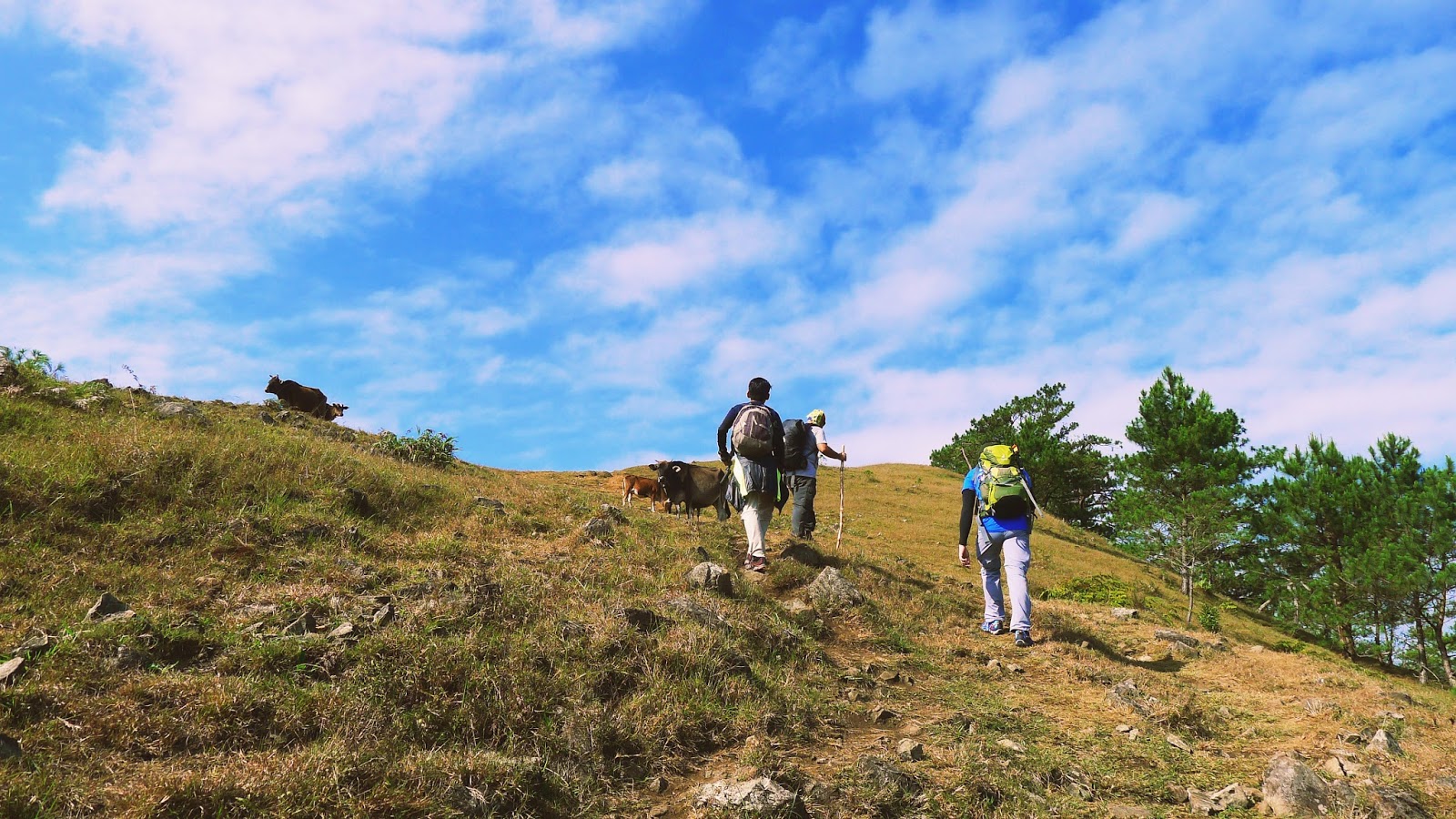
The hike starts off with tall pine trees, grassy trails and cows randomly strutting around.
You are greeted with cool fresh gusts of winds with a spectacular view of Itogon.
You are greeted with cool fresh gusts of winds with a spectacular view of Itogon.

And as you trek through it, high steep slopes open the field that covers most of the entirety of this hike.

The view at the Ambanao Paoay peak is breathtaking. It overviews the lush greens of Itogon.

It's fun being the tail since you see your group struggling hahaha
On our way up the second highest peak - Gungal.

I call this "Totem"
Rock balancing art at the Gungal Peak.
Rock balancing art at the Gungal Peak.
These were made by previous climbers who spent time at the peak. Since the terrain has become dry and rocky with lesser pine trees. There are rocks scattered so you can make your own stacks.

One of the famous spots in the whole trail is the Gungal rock formation.

You are allowed to check around the formation. It's kinda tricky though because right below is a 1856 meters of plunging death. But no worries because the platform is actually quite wide just be careful going near the edge. Take a quick snap and go.

On our way to the highest peak - Mt. Ulap.

You will be descending and ascending the slopes, so taking your time is the key or else you will get tired easily. Not to mention that since this is an open field, there are no more pine trees to cover you from the sun. 

But it still can get fun when you have crazy friends.


Quick break and we're off to descend towards Santa Fe.

Your sign that the hike is about to end when the trail goes back to the bushy pine trees, leveled ground.


/Hanging bridges are fun!
This is one of my new favorite mountain destination so far. It showcases the best of what the Cordilleras has to offer: Pine and grassland ridges with stunning views of the mountains. It's also called the mini-Ugo - a greatly easier version of Mt. Ugo but remarkably captures the same feeling - the feeling of amazement of the beautiful Benguet. Check my Mt. Ugo story here too!
~
MT. ULAP ECO-TRAIL 1846 MASL
Entry point: Brgy. Ampucao, Itogon
Exit point: Brgy. Sta. Fe, Itogon
Days required / Hours to summit: 1 day / 2-3 hours
Specs: Difficulty 3/9, Trail class 1-3

'til next trip.
~


Comments
Post a Comment